The development of St.James’s

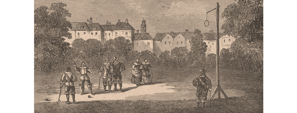
An alley, or track, ran close to the Palace of St. James’s and there the game of ‘palle-maille’ was played. It was developed into a street that formed the southerly border of the suburb of St. James’s and continues to be called Pall Mall.
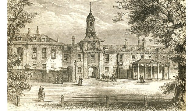
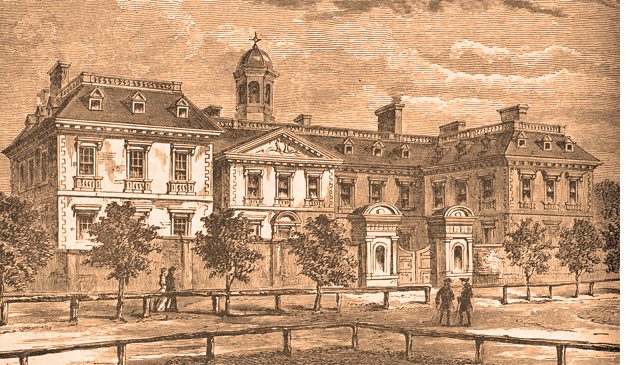
During the 17th century several new developments and large mansions were established to the west of the old City of London, where aristocrats and the wealthy could be near to the royal palaces. One of those developments was the new suburb of St. James’s.
The areas of land to the north and west of Charing Cross had been held by the Hospital of St. Giles during the Middle Ages but came into the ownership of the Crown in 1536 at the dissolution of the monasteries. Subsequently Charles I granted them to his wife, Queen Henrietta Maria.
Henry Jermyn was a controversial and not universally trusted member of the royal court, believed to be the secret lover of both Henrietta Maria – mother of Charles II – and one of her maids of honour. He had been given the title of Earl of St. Albans at the Restoration. “My Lord Henry Germain, Earl of St. Albans, who, above all other individuals” wrote Count Lorenzo Magalotti in 1669, “has been loaded with benefits by her majesty.” From 1660 the Queen Mother began leasing to Jermyn parts of the former St. Giles lands. In 1665 he leased until 1740 (which was later renewed) the remainder of 45 acres of land known as St. James’s Fields. It was bordered on the north by Piccadilly, the east by Haymarket, west by St. James’s Street and the south by Pall Mall.
Jermyn applied to the King to develop St. James’s Fields but faced opposition from the City of London who obtained some of their water from there. Despite that opposition he persuaded the monarch on the basis that there was a local need for houses fit for members of the court. He petitioned Charles: “Ye beauty of this great Towne and ye convenience of your Court are defective in point of houses fitt for ye dwellings of Noble men and other persons of quality…”. The plan involved a number of grand mansions facing a central garden, named St. James’s Square, similar to the Earl of Southampton’s Bloomsbury but in this case exclusively for aristocrats. However, the proposed development was on land leased by Jermyn from the Crown for a fixed period and he found that wealthy members of the court had no interest in building grand palaces for the relatively short periods he could offer. The start of the scheme was also delayed by the Great Plague and Great Fire. Jermyn therefore changed course and leased out plots of land to prominent builders such as Nicholas Bourbon and Richard Frith who then built somewhat smaller town-houses, with work starting in 1665. The final development was quite similar to Bloomsbury, including a market and church.
Together with other associates, such as Sir Thomas Clarges, Jermyn laid out various streets – Jermyn, King, Charles II, Duke, Duke of York, Ryder and Babmaes Streets (the latter named after the King’s servant Baptist May). He also established St. Alban’s Market (more commonly known as St. James’s Market). Plots of land were sub-leased to these speculative builders to construct terraced houses for aristocratic tenants.
The local people of the area commissioned Sir Christopher Wren to design a new parish church between Piccadilly and Jermyn Street to hold 2,000 parishioners, the only Wren church on a completely new site. It was consecrated in 1684, although still not then complete. Wren’s initial steeple design was rejected and the vestrymen instead commissioned a local carpenter to build one. No doubt Wren was quietly amused when the original had to be taken down after it was found to be unsafe once the bells had been installed and in 1700 he was asked back again to complete the work.
Some of the finest houses were those on the south side of Pall Mall that faced across St. James’s Park and that is where the King’s mistress Nell Gwyn and the Countess of Ranelagh lived.
The street of Pall Mall at St. James’s was laid out on a former alley that ran between two rows of elms. It had been used to play a game similar to croquet by the name of ‘palle-maille’ (which in turn was a French adaptation of the Italian ‘pallo a maglio’ meaning ball and mallet). The game had probably been brought to Scotland by Mary, Queen of Scots, and then to England by James I (who is also reputed to have brought golf with him) and was by the mid-century all the rage in France. It was played on a soft surface but carriages were increasingly using the unpaved alley, throwing up dust as they went, so the game was therefore relocated to a new site to the south in 1661. The old alley was upgraded into a street that was initially called Catherine Street after Catherine of Braganza, wife of Charles II, but continued to be known as Pall Mall and was eventually officially changed to that name. The new palle-maille area to the south eventually became the Mall. The close proximity of Pall Mall to St. James’s Palace and the royal park made it a highly desirable location and properties built along it were much sought after.
Charles II gave Henry Bennett, Earl of Arlington an area of land on the corner of St. James’s Street and Piccadilly. He leased it on to a builder named Pym who erected houses of such poor quality they soon had to be demolished. Nevertheless, Arlington Street and Bennett Street were soon fashionable addresses. By the end of the 17th century every small plot of land on either side of St. James’s Street had been built upon.
By the latter part of the 17th century the district of St. James’s between St. James’s Palace and Piccadilly, then north up to and beyond Oxford Road (Oxford Street, around the modern Oxford Circus) and westwards as far as Bond Street, had been developed. There was thereafter a lull in new developments to the west of London that lasted until the succession of George I in 1714 and the creation of Mayfair.
Sources include: John Summerson ‘Georgian London’; Liza Picard ‘Restoration London’; Peter Whitfield ‘London: A Life in Maps; Lisa Jardine ‘On a Grander Scale’; Count Magalotti ‘Travels of Count Cosmo III Grand Duke of Tuscany’ (1669); Adrian Tinniswood ‘By Permission of Heaven’; ‘The Diary of Samuel Pepys’.
< Back to Late-Stuart London


